Flood Zone AO Explained: Risks, Depth, and Insurance Needs
7 min read · Jul 20, 2026
When looking at a federal flood map, finding your property inside a high-risk area can be alarming. One designation that frequently confuses property owners, commercial buyers, and community planners is Flood Zone AO.
Unlike traditional riverine floodplains that anticipate rising rivers or coastal surges, Flood Zone AO is a unique FEMA designation specifically tied to shallow flooding, sheet flow, and rapid stormwater runoff.
For anyone holding a mortgage, managing a commercial asset, or planning a local development project, understanding how flood depth is mapped in an AO zone is critical. It dictates your structural compliance mandates, your legal insurance requirements, and your long-term property risk mitigation strategies.
This guide provides a practical overview of how to interpret the risk of flooding, how depths are determined, and what they mean for the flood insurance policy.
What is Flood Zone AO?
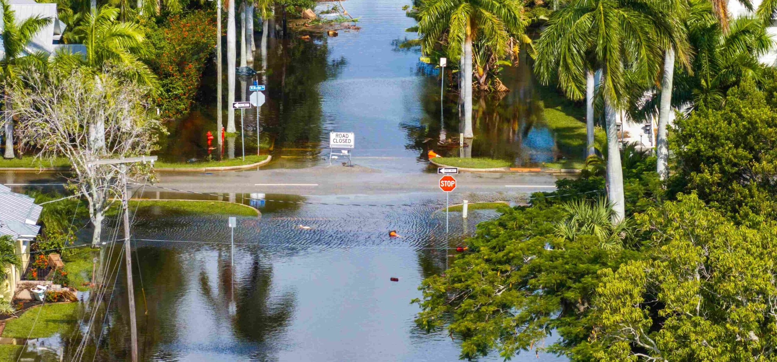
Flood zone AO is a high-risk flood zone mapped by the Federal Emergency Management Agency (FEMA). This area experiences shallow flooding, typically averaging between 1 and 3 feet deep.
The FEMA flood zone AO is part of the Special Flood Hazard Area (SFHA). Properties within an SFHA face a 1% or greater chance of experiencing a flood in any given year. This mathematical probability translates to a 26% chance of flooding over the course of a standard 30-year mortgage. AO zones are associated with shallow flooding caused by sheet flow or stormwater runoff.
Key Characteristics of Flood Zone AO:
- Shallow Sheet Flow: Rather than water rising from a defined channel (like a riverbank), flooding occurs as a wide, continuous sheet of water moving across the ground.
- Sloping Terrain and Runoff: These zones often have steep, mountainous, or hilly areas, as well as alluvial fans, where heavy rain cannot infiltrate the soil and flows rapidly downhill.
- Unpredictable Flow Paths: Because sheet flow is driven by surface topography and localized blockages, the exact path of the water can shift over time based on local development and land grading.
How Flood Depth Works in FEMA Flood Zone AO
A defining characteristic of flood zone AO is how water behavior is quantified. Instead of relying on a fixed sea-level elevation benchmark, FEMA maps these areas by calculating the expected flood depth. On a Flood Insurance Rate Map (FIRM), you will see markers like ZONE AO (DEPTH 1′), ZONE AO (DEPTH 2′), or ZONE AO (DEPTH 3′) printed directly on the zone.
These markers represent the projected depth of water, in feet, relative to the ground surface during a 100-year storm event:
- AO 1: Indicates an expected shallow flood depth of 1 foot
- AO 2: Indicates an expected shallow flood depth of 2 feet
- AO 3: Indicates an expected shallow flood depth of 3 feet
Why Flood Depth Matters for Your Property
Understanding your specific depth marker is crucial because even minor amounts of moving water cause severe structural and financial damage. A depth of just one to three feet could be devastating:
- Flooring and Drywall Destruction: Water easily penetrates structural wall cavities, requiring complete strip-outs of drywall, insulation, and structural framing.
- HVAC and Utility Exposure: Condensers, water heaters, and electrical panels located on the ground or in crawlspaces can suffer complete electrical and mechanical failure.
- Foundation Degradation: Sheet flow exerts lateral hydrostatic pressure on foundations, and it can wash away supporting soil, causing structural shifting in sloped areas.
- Mold and Mildew Proliferation: Trapped moisture within structural elements breeds mold within 24 to 48 hours, significantly inflating remediation costs.
What is the Base Flood Elevation in Flood Zone AO?
In standard high-risk areas like a Flood zone AE, engineers rely on a fixed Base Flood Elevation (BFE). The BFE measures how high water is expected to rise relative to a nationwide vertical datum (like mean sea level).
However, flood zone AO typically does not use traditional BFE measurements. Because sheet flow follows the natural roll of the terrain, a single fixed elevation benchmark across a neighborhood would be mathematically impossible. FEMA provides the specified flood depth number.
To establish building safety and compliance, engineers use a calculation called the Highest Adjacent Grade (HAG). The HAG is the highest point of natural ground directly touching the exterior walls of a structure.
Flood Zone AO Compliance
If the HAG is established, and the map shows an AO 2 designation, the lowest floor of your building must be elevated at least 2 feet above the highest ground point to comply with local floodplain management rules. This structural positioning is a key factor during commercial underwriting, flood risk mitigation planning and construction design.
What Causes Flooding in Zone AO?
Flooding within an AO designation is primarily systemic. It is driven by topography and local microclimates rather than proximity to open bodies of water. The primary causes of flooding include:
- Sheet Flow Flooding: High-volume precipitation hits the ground faster than the soil can absorb it, forcing water to travel over the surface in a broad, shallow layer.
- Rainfall Runoff on Sloped Terrain: Mountainous, hilly, or semi-arid regions with minimal vegetative cover encourage rapid downhill water accumulation.
- Alluvial Fan Dynamics: Debris and sediment wash down mountain canyons, creating fan-shaped deposit fields where water frequently cuts new, unpredictable paths during heavy rainstorms.
- Urban Stormwater Accumulation: Paved surfaces, concrete roads, and commercial parking lots prevent natural infiltration. When severe storms hit, this infrastructure directs massive quantities of water down roadways, overwhelming municipal drainage systems.
Does Flood Zone AO Require Flood Insurance?
Homeowners in flood zone AO, who have a mortgage through a federally regulated or insured lender, are legally required to maintain flood insurance. Because FEMA designates AO as an SFHA (high-risk), lenders must enforce mandatory purchase requirements to safeguard their capital investments.
It is also important to recognize that standard homeowners’ insurance does not cover flood damage. Property owners without a mortgage are technically free from the legal mandate, but skipping coverage is a major financial risk.
Flash floods, sudden mountain runoffs, and severe cloudbursts routinely inundate unmortgaged properties in these zones, leaving owners to pay out of pocket for complete structural rebuilds.
How Zone AO Differs from Zones AH and AE
| Feature | Zone AO | Zone AH | Zone AE |
| Flood Type | Shallow sheet flow flooding | Shallow ponding flooding | Riverine or coastal flooding |
| Typical Depth | 1 to 3 feet | 1 to 3 feet | Varies by location |
| Elevation Reference | Mapped flood depth (1–3 ft) above the Highest Adjacent Grade (HAG); no fixed BFE | Base Flood Elevation (BFE) | Base Flood Elevation (BFE) |
| Insurance Required | Yes, for federally backed mortgages | Yes, for federally backed mortgages | Yes, for federally backed mortgages |
| Water Behavior | Water flows across the ground surface | Water collects in ponds | Water rises from rivers, streams, or coastal sources |
| Common Terrain | Sloped areas, alluvial fans, runoff paths | Flat areas with drainage issues | Riverbanks, coastal areas, floodplains |
How to Check if Your Property is in Flood Zone AO
Confirming your property’s status requires verifying current federal spatial data. You can easily check your risk profile using these three resources:
- The FEMA Flood Map Service Center (MSC): Enter your address into the official portal to pull up the current FIRM panel covering your structure. Check for any shaded areas marked with “Zone AO” and look for any associated depth numbers (1, 2, or 3).
- Lender Flood Determinations: When purchasing or refinancing an asset, your mortgage company will pull an official statutory determination document to see if the structure intersects a high-risk line.
- Private Flood Insurance Agents: A licensed agent can run your exact latitude and longitude coordinates through advanced Geographic Information System (GIS) mapping platforms. This lets you view your digital regulatory standing alongside real-time terrain elevations.
Conclusion
Flood zone AO is a high-risk designation where shallow sheet flow and stormwater runoff threaten your real estate investments. While 1 to 3 feet of water, as designated by the AO 1 through AO 3 markers, may sound negligible compared to a major coastal surge, it is more than enough to cause catastrophic structural and financial damage to a property.
Knowing your mapped flood depth gives you the insight needed to build safely, stay compliant with local construction codes, and implement smart structural defenses. Don’t leave your single largest asset exposed to changing weather patterns and flash runoff events.
Take control of your flood risk management today. Get a customized flood insurance quote in under two minutes with Neptune Flood Insurance and ensure your property stays fully covered.
FAQs
What are FEMA flood zones?
FEMA flood zones are geographic designations defined by the Federal Emergency Management Agency on official Flood Insurance Rate Maps (FIRMs). Each zone represents a different level of probability for structural flooding, ranging from low-risk zones (such as X or C) to high-risk Special Flood Hazard Areas (such as AO, AH, or AE).
Is flood zone AO considered high risk?
Yes, Flood Zone AO is classified as a Special Flood Hazard Area (SFHA). Properties within this zone have a 1% or higher annual chance of experiencing a flood, which means flood insurance is mandatory if you hold a federally backed mortgage.
What does AO 2 or AO 3 mean on FEMA maps?
These designations represent the projected depth of floodwater during a 100-year storm event. An AO 2 designation means FEMA expects up to 2 feet of shallow sheet flow water above the highest adjacent grade, while an AO 3 indicates an expected water depth of up to 3 feet.
How does flood zone AO impact property buyers and homeowners?
Buying a house in a Zone AO-designated region means you need to adhere to the mandatory flood insurance requirement. You must factor flood insurance premiums into your carrying costs. For homeowners planning additions or renovations, it means local building codes will require you to elevate your lowest structural floors above the highest adjacent ground level plus the mapped depth.
What are the worst flood zone codes?
The highest-risk flood zones on FEMA maps are those starting with the letters V and A. “V” zones (like VE) are coastal zones facing high-velocity waves and storm surges. “A” zones (like AE, AH, and AO) face severe inland, riverine, or flash sheet-flow flooding.
How much does flood insurance cost in Zone AO?
Under the National Flood Insurance Program (NFIP), cost varies based on individual structural parameters under Risk Rating 2.0. Factors like your foundation design, your first floor’s elevation relative to water flow paths, your structural replacement costs, and your proximity to slopes determine your final premium. Using private flood insurance alternatives, rather than the NFIP, can often save you up to 25%.
